This course equips learners with the skills to utilize Python and open-source libraries for building lightweight, portable GIS desktop applications. It emphasizes practical, hands-on techniques for integrating geospatial data and tools, allowing both beginners and experienced developers to engage in advanced spatial analysis.

Python Geospatial Development Essentials
Seize the savings! Get 40% off 3 months of Coursera Plus and full access to thousands of courses.

Gain insight into a topic and learn the fundamentals.
Beginner level
Recommended experience
1 week to complete
at 10 hours a week
Flexible schedule
Learn at your own pace
What you'll learn
Design and structure a basic GIS application using existing tools
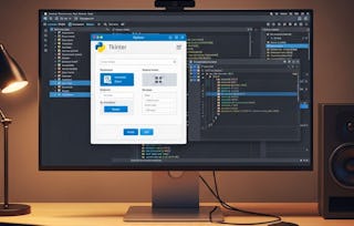
Customize Tkinter widgets to create a reusable GIS toolkit
Load, manipulate, and visualize both vector and raster spatial data
Skills you'll gain
Tools you'll learn
Details to know

Shareable certificate
Add to your LinkedIn profile
Recently updated!
January 2026
Assessments
8 assignments
Taught in English
See how employees at top companies are mastering in-demand skills

There are 8 modules in this course
In this section, we explore building a GIS application using Python and Tkinter, focusing on user-friendly design, geospatial libraries, and practical implementation for specific tasks.
What's included
2 videos3 readings1 assignment
In this section, we implement data interfaces for vector and raster geospatial data, analyze format-specific loaders, and design lightweight solutions for practical GIS applications.
What's included
1 video7 readings1 assignment
In this section, we design a structured Tkinter GUI for a GIS application, focusing on modular widget creation and layout testing for efficient development.
What's included
1 video5 readings1 assignment
In this section, we explore dividing geographic data rendering into thematic layers, implementing vector and raster graphics, and linking them to an interactive map UI for efficient visualization.
What's included
1 video6 readings1 assignment
In this section, we create tools for inspecting geographic data, implement batch operations for vector and raster layers, and design parameter dialogue windows for management functions.
What's included
1 video4 readings1 assignment
In this section, we implement vector data overlay and raster zonal statistics, and integrate analysis tools into user interfaces for practical geographic data analysis.
What's included
1 video2 readings1 assignment
In this section, we assign a custom icon, create a self-contained executable using py2exe, and design an installer for easy distribution of the application.
What's included
1 video4 readings1 assignment
In this section, we explore enhancing the GIS application's user interface, adding advanced GIS features, and expanding platform compatibility for broader usability.
What's included
1 video3 readings1 assignment
Instructor

Offered by


Explore more from Software Development
 Status: Free Trial
 Status: Free Trial
Rice University
 Status: Preview
Simplilearn

Why people choose Coursera for their career

Felipe M.
Learner since 2018
"To be able to take courses at my own pace and rhythm has been an amazing experience. I can learn whenever it fits my schedule and mood."

Jennifer J.
Learner since 2020
"I directly applied the concepts and skills I learned from my courses to an exciting new project at work."

Larry W.
Learner since 2021
"When I need courses on topics that my university doesn't offer, Coursera is one of the best places to go."

Chaitanya A.
"Learning isn't just about being better at your job: it's so much more than that. Coursera allows me to learn without limits."

Open new doors with Coursera Plus
Unlimited access to 10,000+ world-class courses, hands-on projects, and job-ready certificate programs - all included in your subscription
Advance your career with an online degree
Earn a degree from world-class universities - 100% online
Join over 3,400 global companies that choose Coursera for Business
Upskill your employees to excel in the digital economy
Frequently asked questions
Yes, you can preview the first video and view the syllabus before you enroll. You must purchase the course to access content not included in the preview.
If you decide to enroll in the course before the session start date, you will have access to all of the lecture videos and readings for the course. You’ll be able to submit assignments once the session starts.
Once you enroll and your session begins, you will have access to all videos and other resources, including reading items and the course discussion forum. You’ll be able to view and submit practice assessments, and complete required graded assignments to earn a grade and a Course Certificate.
More questions
Financial aid available,